- Data Basin |
- Maps |
- Chattahoochee River Recreation Access - Needs and Opportunities
Chattahoochee River Recreation Access - Needs and Opportunities
Mar 8, 2012
(Last modified Mar 21, 2012)
Created by
Brenda Faber
- Description
- The Lincoln Institute – Large Landscape Tools and GIS Portal Project
Proof of Concept Demonstration - Chattahoochee River Recreation Access
The objective of the Large Landscape Tools and GIS Portal Project is to provide design recommendations for an online platform of data and tools that uniquely support and advance large landscape conservation. Key to this effort is a focus on online resources - resources that are immediately available as needed, and can be shared among partners. The project is sponsored by The Lincoln Institute of Land Policy with support from the Doris Duke Charitable Foundation and performed by The Trust for Public Land - National Conservation Vision and GIS Team.
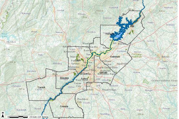
A key component of this project is to provide proof of concept examples that demonstrate conceptual large landscape web tools within the context of premier North American large landscape initiatives. The Chattahoochee River corridor in the Greater Atlanta area was selected as a focal urban landscape for this purpose.
On February 29, 2012 Secretary of the Interior Ken Salazar unveiled the National Water Trails System , a new network that will increase access to water-based outdoor recreation, encourage community stewardship of local waterways, and promote tourism that fuels local economies across America. The Chattahoochee River Water Trail in Georgia was the first river to be designated as a National Water Trail System under the new program.
This demonstration project explores opportunities to expand the Chattahoochee River Water Trail beyond its current extent.
- Location

- Credits
- The Lincoln Institute for Land Policy, The Trust for Public Land
- Use Constraints
 This work is licensed under a Creative Commons Attribution 3.0 License.
This map is visible to everyone