- Data Basin |
- Maps |
- Deepwater Horizon Oil Spill in Desoto Canyon Marine Protected Area
Deepwater Horizon Oil Spill in Desoto Canyon Marine Protected Area
Dec 16, 2010
Created by
Kai Henifin

- Description
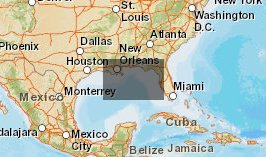
- This map overlays the Deepwater Horizon Oil Spill Trajectory (6/24/2010) with the Marine Protected Areas (MPA) Inventory layer.
- Location
- Credits
- Kai Henifin
- Use Constraints
 This work is licensed under a Creative Commons Attribution 3.0 License.
- This map is based on
-
This map is visible to everyone
About the Map Author
Kai Henifin
Climate and Fire Resilience Coordinator with Pepperwood
I am a Project Manager and Senior GIS Specialist with more than a decade of experience working with diverse stakeholder groups to co-produce high quality science information that is accessible to a wide range of people, both technical and non-technical. I have an expertise in developing, managing...