- Data Basin |
- Datasets |
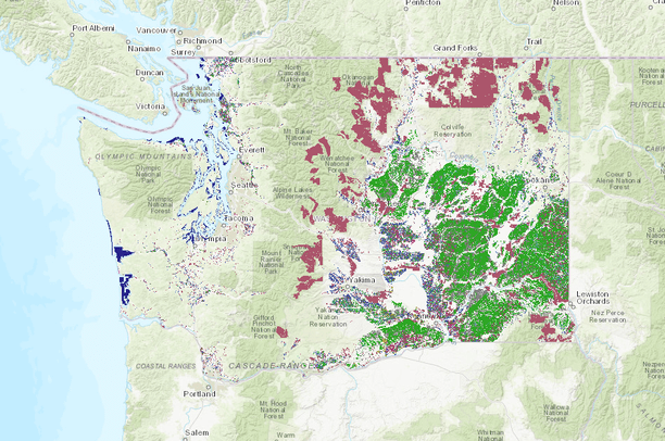
- Washington State Agricultural Land Use - 2022
Washington State Agricultural Land Use - 2022
- Description:
This dataset contains crop information collected and stored for Washington. It consists of polygons representing individual crop field borders with attributes including crop, irrigation, survey date, TRS, county, source, cover crop, and acres. Attributes are updated by WSDA staff via ground surveys or by using remote sensing sources such as USDA's NASS Cropland Data Layer. Other sources include obtaining data directly from producers, using aerial or satellite imagery, and enlisting resources from Conservation Districts, etc. This land use data is published annually but is not updated in its entirety each year. WSDA strives to maintain a minimum 4 year refresh schedule for each geographic area with a target goal of every 2 years in dryland areas and 3 years in irrigated agricultural basins. For this reason, this dataset is not statistical, but it does provide an accurate snapshot of crops growing in each geographic area and provides trends over time. Since only one crop can be captured in a given space, double-crop systems cannot be captured. These systems are documented in the notes attribute and rotation crop attribute when confirmed. WSDA partners with USDA NASS and provides ground-truthed data for the Cropland Data Layer project, especially in areas not well represented by USDA FSA data.
- Data Provided By:
- Content date:
- 2022
- Contact Organization:
- Washington State Department of Agriculture
- Contact Person(s):
- Use Constraints:
- Disclaimer: This data is provided 'as is' without warranty of any kind, either expressed or implied, including, but not limited to, the implied warranties of merchantability and fitness for a particular use. The Natural Resources Assessment Section of Washington State Department of Agriculture will not be liable to the user of this data for any activity involving the data with respect to the following: (a) lost profits, lost savings, or any other consequential damages; (b) the fitness of the data for a particular purpose; or (c) use of the data or results obtained from the use of the data.
- Layer:
- Layer Type:
- Currently Visible Layer:
- All Layer Options:
- Layers in this dataset are based on combinations of the following options. You may choose from these options to select a specific layer on the map page.
- Description:
- Spatial Resolution:
- Credits:
- Citation:
- Purpose:
- Methods:
- References:
- Other Information:
- Time Period:
- Layer Accuracy:
- Attribute Accuracy:
- Dataset Type:
-
Layer Package
About the Uploader
We provide advanced conservation science, technology, and planning to empower our partners in solving the world’s critical ecological challenges