- Data Basin |
- Datasets |
- Colville National Forest - Administrative Boundary (admin_forest)
Colville National Forest - Administrative Boundary (admin_forest)
Aug 8, 2014
Uploaded by
George Wooten
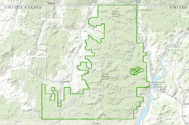
- Description:
- Colville National Forest Administrative Boundary
- Data Provided By:
- USDA Forest Service - Colville National Forest
- Content date:
- not specified
- Contact Organization:
- Colville National Forest - Supervisors Office
- Contact Person(s):
- Use Constraints:
- Neither the United States Government nor any of it's employees make any warranty, express or implied, including the warranties of merchantability and fitness for a particular purpose, or assumes any legal liability or responsibility for the accuracy, completeness, or usefulness of any information, apparatus, product, or process disclosed, or represents that its use would not infringe privately owned rights. The United States Government is not responsible for the contents of any off site pages referenced.
- Layer:
- Layer Type:
- Currently Visible Layer:
- All Layer Options:
- Layers in this dataset are based on combinations of the following options. You may choose from these options to select a specific layer on the map page.
- Description:
- Spatial Resolution:
- Credits:
- Citation:
- Purpose:
- Methods:
- References:
- Other Information:
- Time Period:
- Layer Accuracy:
- Attribute Accuracy:
FGDC Standard Metadata XML
Click here to see the full FGDC XML file that was created in Data Basin for this layer.
Original Metadata XML
Click here to see the full XML file that was originally uploaded with this layer.
This dataset is visible to everyone
- Dataset Type:
-
Layer Package
Downloaded by
3 Members
Bookmarked by
2 Groups
Included in
1 Public Map
,
1 Private Map
About the Uploader
George Wooten
Biogeographer with Wenatchee Valley College
I am a botanist and microbiologist. Other completed project reports can be downloaded at http://www.okanogan1.com