- Data Basin |
- Datasets |
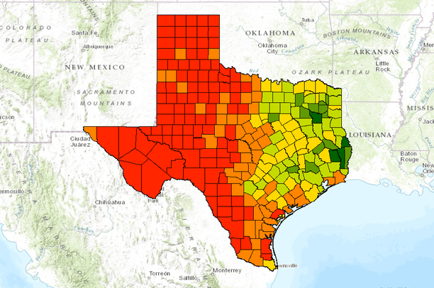
- Texas Land Trends - Ownership Size
Texas Land Trends - Ownership Size
Apr 9, 2014
Uploaded by
Gulf Coast Prairie LCC
- Description:
- By the end of 2007, the USDA Census of Agriculture accounted for over 247,000 farming and ranching operations in the state. This represents an 8% increase since the census of 1997. In other words, Texas annually gained about 1,900 new working farms and ranches. However, the land base for Texas agriculture has decreased by as much as 2% during the same period. Average ownership size declined from 585 acres in 1997 to 527 acres in 2007.
- By 2007, smaller operations – those less than 100 acres in size – accounted for over 50% the state’s total farming & ranching operations, while occupying only 3% of the land area. This class of smaller operations increased by 22% since 1997, and was the only ownership size class showing an overall net increase in land area across the state.
- The amount of land in mid-sized farms & ranches (500 to 2,000 acres) has continued to decline at the rate of about 250,000 acres per year.
- Large ownerships – those greater than 2000 acres in size – account for about 4% of all farms & ranches, but they occupy about 62% of the state’s total farm & ranchland. While larger operations have slightly increased in total number since 1997, they have decreased in land area by 461,000 acres.
- The loss or gain in area represented by large operations varied according to ecological region. For example, since 1997 over 2.8 million acres of larger farms & ranches in the Trans Pecos, Edwards Plateau and South Texas were fragmented into mid-sized and smaller ownerships. In other regions – the High Plains, Rolling Plains, Coastal Sand Plains, Oak Woods & Prairies, and Blackland Prairies – about 2.5 million acres of mid-sized properties were consolidated into larger operations.
- Data Provided By:
- Wilkins, R. Neal, Amy G. Snelgrove, Blair C. Fitzsimons, Brent M. Stevener, Kevin L. Skow, Ross E. Anderson, Amanda M. Dube. "Texas Land Trends." Texas A&M Institute of Renewable Natural Resources. 2009. Texas A&M University.
- Content date:
- not specified
- Citation:
- Texas Land Trends
- Contact Organization:
- Texas A&M Institute of Renewable Natural Resources
- Contact Person(s):
- not specified
- Use Constraints:
 This work is licensed under a Creative Commons Attribution 3.0 License.
- Layer:
- Layer Type:
- Currently Visible Layer:
- All Layer Options:
- Layers in this dataset are based on combinations of the following options. You may choose from these options to select a specific layer on the map page.
- Description:
- Spatial Resolution:
- Credits:
- Citation:
- Purpose:
- Methods:
- References:
- Other Information:
- Time Period:
- Layer Accuracy:
- Attribute Accuracy:
FGDC Standard Metadata XML
Click here to see the full FGDC XML file that was created in Data Basin for this layer.
Original Metadata XML
Click here to see the full XML file that was originally uploaded with this layer.
This dataset is visible to everyone
- Dataset Type:
-
Layer Package
Downloaded by
3 Members
Bookmarked by
1 Group
Included in
2 Public Galleries
About the Uploader
Gulf Coast Prairie LCC
with Gulf Coast Prairie Landscape Conservation Cooperative
This is the admin account for the Gulf Coast Prairie LCC Conservation Planning Atlas