- Data Basin |
- Datasets |
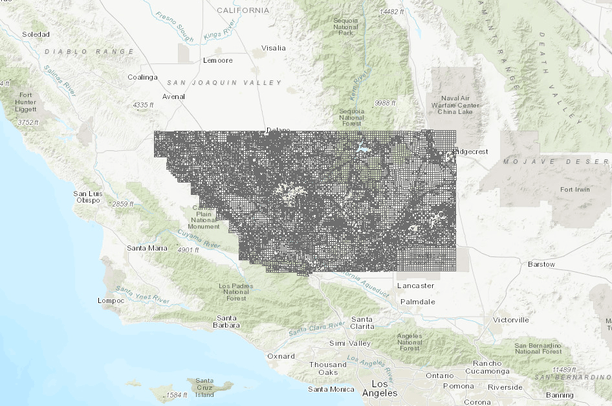
- Parcels 2019, Kern County
Parcels 2019, Kern County
Jun 25, 2015
(Last modified Mar 6, 2020)
Uploaded by
Conservation Biology Institute
- Description:
- This feature class contains "land" (surface rights) parcel boundaries delineated for property tax assessment purposes. This data includes all private (taxable), state utility, and other governmental (tax exempt) land parcels listed on the secured tax roll, but does not include mineral rights (subsurface) parcels, mobilehomes, or unsecured taxable entities. Parcels are modeled as planimetric polygons in a seamless fabric comprising the spatial extent of the County of Kern, in the State of California.
- Data Provided By:
- Kern County Planning Department
- Content date:
- not specified
- Contact Organization:
- not specified
- Contact Person(s):
- not specified
- Use Constraints:
 This work is licensed under a Creative Commons Attribution 3.0 License.
- Layer:
- Layer Type:
- Currently Visible Layer:
- All Layer Options:
- Layers in this dataset are based on combinations of the following options. You may choose from these options to select a specific layer on the map page.
- Description:
- Spatial Resolution:
- Credits:
- Citation:
- Purpose:
- Methods:
- References:
- Other Information:
- Time Period:
- Layer Accuracy:
- Attribute Accuracy:
FGDC Standard Metadata XML
Click here to see the full FGDC XML file that was created in Data Basin for this layer.
Original Metadata XML
Click here to see the full XML file that was originally uploaded with this layer.
This dataset is visible to everyone
- Dataset Type:
-
Layer Package
Downloaded by
21 Members
Bookmarked by
3 Groups
Included in
277 Public Maps
,
1922 Private Maps
Included in
1 Public Gallery
About the Uploader
Conservation Biology Institute
We provide advanced conservation science, technology, and planning to empower our partners in solving the world’s critical ecological challenges