- Data Basin |
- Datasets |
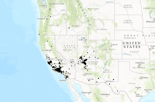
- California Condor Occurrences
California Condor Occurrences
Jul 15, 2015
(Last modified Nov 9, 2016)
Uploaded by
PacificSouthwestRegion
This map service is unavailable
- Description:
- Calfifornia condor occurrence data, downloaded from USGS BISON. The USGS Biodiversity Information Serving Our Nation (BISON) project is an online mapping information system consisting of a large collection of species occurrence datasets (e.g., plants and animals) found in the United States, with relevant geospatial layers. Species occurrences are records of organisms at a particular time and location that are often collected as part of biological field studies and taxonomic collections. These data serve as a foundation for biodiversity and conservation research. BISON supports several data interchange formats to enable developers to write custom applications (http://bison.usgs.ornl.gov/services.html). The BISON search API supports JavaScript Object Notation (JSON). The SOLR search API supports JSONP. The Web Mapping Services support Portable Network Graphics (PNG). Example Web services applications have been written using OpenLayers, and HTML 5 and we are working on mobile applications.
- Data Provided By:
- Multiple sources, compiled and hosted by USGS BISON.
- Data Hosted by:
- ScienceBase (USGS) View Record
- Map Service URL:
- https://www.sciencebase.gov/arcgis/rest/services/Catalog/55a55295e4b0183d66e45ba5/MapServer/
- Content date:
- 2016-11-04 (Acquisition)
- Contact Organization:
- not specified
- Contact Person(s):
- not specified
- Use Constraints:
- non-sensitive data
- Layer:
- Layer Type:
- Currently Visible Layer:
- All Layer Options:
- Layers in this dataset are based on combinations of the following options. You may choose from these options to select a specific layer on the map page.
- Description:
- Spatial Resolution:
- Credits:
- Citation:
- Purpose:
- Methods:
- References:
- Other Information:
- Time Period:
- Layer Accuracy:
- Attribute Accuracy:
FGDC Standard Metadata XML
Click here to see the full FGDC XML file that was created in Data Basin for this layer.
Original Metadata XML
Click here to see the full XML file that was originally uploaded with this layer.
This dataset is visible to everyone
- Dataset Type:
-
External Map Service (ArcGIS)
Bookmarked by
1 Member
,
2 Groups
Included in
2 Public Maps
Included in
2 Public Galleries
[{"url": "https://www.sciencebase.gov/catalog/file/get/55a55295e4b0183d66e45ba5", "title": "Download All Attached Files from ScienceBase"}, {"url": "https://www.sciencebase.gov/catalog/file/get/55a55295e4b0183d66e45ba5?f=__disk__60%2F2a%2Fdc%2F602adc0ced071c04c038ad8524467fe7761ee547", "title": "Download Original Metadata"}]
About the Uploader
PacificSouthwestRegion
Multiple Administrators with US Fish and Wildlife Service
This US Fish and Wildlife User Group is responsible for maintaining the Pacific Southwest Region Web Mapping Portal