- Data Basin |
- Datasets |
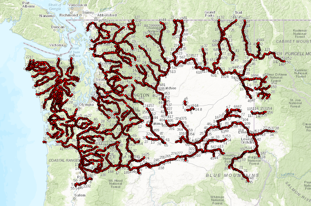
- Washington State River Miles (USGS-WDFW) (2014)
Washington State River Miles (USGS-WDFW) (2014)
- Description:
Ecology created the GIS statewide river mile point layer in March 2007 by digitizing the river mile points depicted on the USGS 7½ minute (24k) topographic quadrangle maps. Some of the rivers have gaps in the river mile progression because several of the quadrangle maps do not have any river mile points, while a few were missing a point or two.
In November 2014 Ecology added river mile points for the missing areas using Washington Department of Fish and Wildlife's (WDFW) 1975 Stream Catalog, which only covers WRIA's 1 through 24. The Stream Catalog shows river miles for nearly every stream; however, only those water courses that have river miles from the USGS quadrangle maps were added.
The field SOURCE denotes the source of the data point, USGS or WDFW.
Discrepancies between the USGS and WDFW are documented in the Supplemental Information section.
Supplemental Information:
USGS 7½ quadrangle maps with no river mile points: Aberdeen SE, Astoria, Auburn, Bacon Peak, Big Devil Creek, Black Diamond, Burnt Peak, Carlisle, Cathlamet Bay, Chinook, Clark Mtn, Colfax North, Copalis Crossing, Des Moines, Diamond, Elberton, Everett, Fort Simcoe, Glacier, Gold Bar, Grant Orchards, Greenwater, Groat Mountain, Index, Lake Lawrence, Mabton East, McKays Butte, Maltby, Maple Valley, Moses Lake NW, Mount Vernon, Mt Blum, Mt Juniper, Mt Larabee, Mt Lyall, Mt Sefrit, Naches, Newaukum Lake, Onalaska, Onalaska NW, Poverty Bay, Prosser, Puyallup, Renton, Rosburg, Seattle South, Smith Creek Butte, Snohomish, Snoqualmie Lake, South Bend, Stanwood, Tacoma North, Tacoma South, Thorp, Toppenish Mtn, Trinity, Vail, Warrenton, Western, White Swan, Whitstram.
On the Columiba River, river mile 681 is missing since it's missing on the USGS 7½ quadrangle, Rice. There are two versions of the Rice quandrangle map. One is missing mile marker 681 and the other, mile marker 691. This layer is missing the 681 mile marker.
Additional points for WRIAs 1-24 added using river mile points based on Washington Department of Fish & Wildlifes, 1975 Stream Catalog.
Stream Catalog points were added where they would match the USGS sequence. At "match points" where USGS and WDFW river miles meet, a point was added even though points were close in distance or out of numerical sequence. Priority was given to the USGS points where they were close together or both points are presented even if they have the same number. Discrepancies between the two sources occur mostly in the coastal (western) rivers.Discrepancies:
WRIA 4:
Big Beaver Creek - River mile 10 repeated.
WRIA 9:
Green River - River mile 69 repeated.
WRIA 11:
Nisqually River has no USGS river mile points.
WRIA 20:
Bogachiel River - USGS river mile 33.8 is upstream of WDFW river mile 34.
WRIA 21:
Clearwater River - WDFW miles off by one mile, river mile 29 repeated. Queets River - WDFW miles off by one mile, river mile 48 repeated. Quinault River - WDFW miles off by one mile , river mile 67 repeated. Quinault River, North Fork - WDFW river mile 15 downstream of USGS river mile 14.8.
WRIA 22:
Canyon River - WDFW river mile10 and USGS river mile 9.2 are very close. Humptulips River - WDFW river mile 18 downstream of USGS river mile 17.2. Humptulips River, West Fork - WDFW river mile sequence off by one mile. No river mile 57. Naselle River - WDFW mile off by one mile, river mile 17 repeated. Satsop River, Middle Fork - WDFW miles off by one mile, river mile 28 repeated. Wynoochee River - WDFW’s miles are off and WDFW river mile 63 is upstream of USGS river mile 64.5.
WRIA 24:
North River - River miles 21 & 22 close together, no river mile 58. Willapa River - WDFW river mile 7 upstream of USGS river mile 8.
- Data Provided By:
-
Washington State Department of Ecology
Dataset downloaded from: http://www.ecy.wa.gov/services/gis/data/data.htm
- Content date:
- 2014
- Contact Organization:
- not specified
- Contact Person(s):
- not specified
- Use Constraints:
- Copyright © 1994-2016. Washington State Department of Ecology. All rights reserved. Web Communications Manager, Washington State Department of Ecology, PO Box 47600, Olympia, WA 98504-7600, 360-407-6590. Permissions Unless specifically identified as the property of another party, all text, data, images, audio, and video (collectively, the “Material”) found on Ecology's Web sites, including www.ecy.wa.gov, apps.ecy.wa.gov, 1800recycle.wa.gov, and the linked database and map servers, are the copyrighted property of the Washington State Department of Ecology. Parties other than Ecology may own copyright in other content on these Web sites. Ecology specifically retains any rights, including possible copyright, that it may have in the Material. The Material on the Web site is intended for users' educational or research purposes. Commercial and political use of any Ecology Material are specifically prohibited. This restriction includes any commercial publication of material and any use in a political campaign or lobbying effort for any person, party or ballot measure. Specific terms of use: Links to Ecology's Web sites - unrestricted Use of data from Ecology's Web sites - provided the Washington State Department of Ecology is credited as the data provider and a link is provided to the Ecology data source Web page. Use of images, audio and video from Ecology's Web sites - for non-commercial purposes only, provided: Users maintain all copyright notices and other notices contained therein; Users credit the Washington State Department of Ecology; and If publishing or distributing printed or electronic copies of the Material or works derived from the Material, users offer the works freely and openly to others under the terms stated here. All other uses of Material from Ecology's Web sites are prohibited without prior express written authorization from Ecology. Marks Many of the trademarks, service marks, and logos (collectively, the “Marks”) displayed on this Web site, including www.ecy.wa.gov, apps.ecy.wa.gov, 1800recycle.wa.gov, and the linked database and map servers, are registered and/or unregistered marks of the Washington State Department of Ecology. Any unauthorized use of the Marks, without express license in writing from Ecology, is strictly prohibited. Limitation of Liability Without limiting the foregoing, all Material on Ecology's Web sites is provided "AS IS" WITHOUT A WARRANTY OF ANY KIND, EITHER EXPRESS OR IMPLIED, INCLUDING BUT NOT LIMITED TO THE IMPLIED WARRANTIES OF MERCHANTABILITY, FITNESS FOR A PARTICULAR USE, AND/OR NON-INFRINGEMENT. Disclaimer Information provided on Ecology's Web sites is accurate to the best of Ecology's knowledge and is subject to change on a regular basis, without notice. Ecology cannot and does not warrant that the information on this Web site is absolutely current, although every effort is made to ensure that it is kept as current as possible. Ecology cannot and does not warrant the accuracy of these documents beyond the source documents, although every attempt is made to work from authoritative sources. Links to related sites are provided as a courtesy, but Ecology is not responsible for their availability, content or policies. Any legal questions regarding this copyright notice and disclaimer, or other questions regarding the use of the Material from Ecology's Web sites, may be directed to Web Communications Manager, Washington State Department of Ecology, PO Box 47600, Olympia, WA 98504-7600, 360-407-6590. The Washington State Department of Ecology reserves the right to change this policy at any time without notice. Other Copyright Holders If you are the owner, or a person authorized on behalf of the owner, of a copyright that allegedly is infringed on Ecology's Web sites, please send a written, signed notification to Web Communications Manager, Washington State Department of Ecology, PO Box 47600, Olympia, WA 98504-7600.
- Layer:
- Layer Type:
- Currently Visible Layer:
- All Layer Options:
- Layers in this dataset are based on combinations of the following options. You may choose from these options to select a specific layer on the map page.
- Description:
- Spatial Resolution:
- Credits:
- Citation:
- Purpose:
- Methods:
- References:
- Other Information:
- Time Period:
- Layer Accuracy:
- Attribute Accuracy:
- Dataset Type:
-
Layer Package
About the Uploader
I have a background in watershed science, collaboration, data collection, and geospatial data management. I currently work for Conservation Biology Institute as the Freshwater Specialist/GIS Technician.