- Data Basin |
- Maps |
- Little San Bernardino Mtns. Linanthus - Species Distribution Model Map, DRECP
Little San Bernardino Mtns. Linanthus - Species Distribution Model Map, DRECP
Apr 24, 2013
(Last modified Dec 18, 2013)
Created by
Conservation Biology Institute
- Description
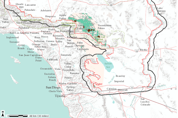
- This map shows output from the UC Davis statistical (Maxent) species distribution model for the Little San Bernardino Mtns. Linanthus, Linanthus maculatus.
The output includes continuous and binary data for the area within 20 km of the species known range. The binary layer depicting predicted suitable habitat was derived using a threshold maximizing the sum of sensitivity and specificity (max SSS).For Linanthus maculatus, Max Sensitivity + Specifity threshold = 0.34; AUC-cross validation = 0.96; pwdAUC = 0.601.Disclaimer: Species occurrence data shown on map are not a 100% complete representation of all locations of a given species.
- Location

- Credits
- Conservation Biology Institute
- Use Constraints
 This work is licensed under a Creative Commons Attribution 3.0 License.
- This map is based on
-
This map is visible to everyone
Bookmarked by
2 Groups
Included in
2 Public Galleries
About the Map Author
Conservation Biology Institute
We provide advanced conservation science, technology, and planning to empower our partners in solving the world’s critical ecological challenges