- Data Basin |
- Maps |
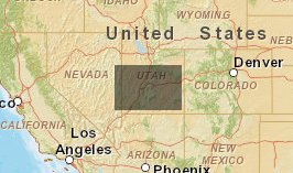
- Grazing/Range Allotments, Pastures & SWReGAP Landcover for Fishlake N.F.
Grazing/Range Allotments, Pastures & SWReGAP Landcover for Fishlake N.F.
Mar 4, 2011
Created by
Grand Canyon Trust
- Description
- USFS Livestock Allotments & Pastures overlayed on USGS-GAP SWReGAP Landcover (Vegetation Types)
- Location

- Credits
- steve fluck
- Use Constraints
 This work is licensed under a Creative Commons Attribution 3.0 License.
This map is visible to everyone
About the Map Author

Grand Canyon Trust
Focused on the Colorado Plateau the Grand Canyon Trust GIS Program provides geographic information science support across all programs to further enhance the overall mission of GCT to protect and restore the Colorado Plateau. Such support includes cartographic design and mapping, database...


