- Data Basin |
- Maps |
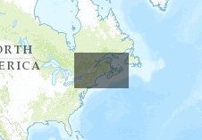
- Human Footprint of the Northern Appalachian/Acadian Ecoregion
Human Footprint of the Northern Appalachian/Acadian Ecoregion
Dec 18, 2013
(Last modified Feb 24, 2014)
Created by
2C1Forest

- Description
- The Human Footprint (HF) of the Northern Appalachian/Acadian ecoregion measures the extent and relative intensity of human influence on terrestrial ecosystems at a resolution of 90 m using best available data sets on human settlement (population density, dwelling density, urban areas), access (roads, rail lines), landscape transformation (landuse/landcover, dams, mines, watersheds), and electrical power infrastructure (utility corridors). Each 90m grid cell is attributed with a Human Footprint score between 0 and 100, where 0 represents minimum human influence and 100 represents maximum human influence at that location. The Human Footprint scores (0-100) may be interpreted as the percent influence.
- Location
- Credits
- WCS Canada
- Use Constraints
 This work is licensed under a Creative Commons Attribution 3.0 License.
This map is visible to everyone
Bookmarked by
3 Members
Included in
1 Public Gallery
About the Map Author
2C1Forest
with Two Countries, One Forest
A Canadian-U.S. collaborative of conservation organizations, researchers, foundations and conservation-minded individuals. Our international community is focused on the protection, conservation and restoration of forests and natural heritage from New York to Nova Scotia, across the Northern...