- Data Basin |
- Maps |
- Land Cover and Habitat Types
Land Cover and Habitat Types
Jan 15, 2016
(Last modified Feb 2, 2016)
Created by
Inyo County Planning Department
- Description
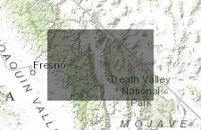
- This map depicts vegetation types and land covers in the OVSES. Information reflects HELIX field surveys and LADWP data. Vegetation types depicted on the vegetation map represent the best fit of the vegetation types observed in the field to the hierarchical classification system employed in A Manual of California Vegetation, 2nd Edition (MCV; Sawyer et al. 2009) and are depicted at the MCV Group level. Alliance-level classifications as well as analogous communities from descriptions in Holland (1986), or Holland as revised by Oberbauer et al. (2008), are available for each polygon by clicking on the interactive map. Summaries of vegetation and land cover in the OVSES, and descriptions of the vegetation and land cover types depicted on the vegetation map are provided in Chapter 6 of this appendix. Information regarding regionally-occurring special-status species associated with those habitats is provided in Chapter 7 of this appendix.
- Location

- Credits
- Helix Environmental Plannning, Inc., Inyo County
- Use Constraints
 This work is licensed under a Creative Commons Attribution 3.0 License.
This map is visible to everyone
Included in
2 Public Galleries
About the Map Author
Inyo County Planning Department
with County of Inyo
The Planning Department is charged with the orderly growth and development of the County while maintaining its quality of life and natural environment. We serve as staff to the Inyo County Planning Commission; administer the County's Zoning, Subdivision, Environmental Review, and Surface Mining...


