- Data Basin |
- Maps |
- Draft Blueprint 2.2 with Aquatic and Waterscape Indicators
Draft Blueprint 2.2 with Aquatic and Waterscape Indicators
Apr 12, 2017
Created by
John Faustini

- Description
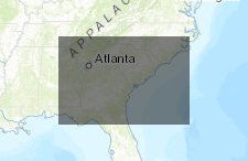
- Map showing Draft Blueprint 2.2 Shared Conservation Priority Areas with Aquatic and Waterscape Indicators
- Location
- Credits
- John Faustini
- Use Constraints
 This work is licensed under a Creative Commons Attribution 3.0 License.
This map is visible to everyone
About the Map Author
John Faustini
Hydrologist with USFWS
I am a hydrologist at the U.S. Fish and Wildlife Service Southeast Region office in Atlanta. I have a background in hydrology (both surface and groundwater) and fluvial geomorphology, and have worked in the private sector, academia, and the federal government. In my current position, I work on...