- Data Basin |
- Maps |
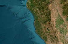
- Elevation and Hillshade of the Fort Bragg Headlands
Elevation and Hillshade of the Fort Bragg Headlands
Nov 6, 2018
(Last modified Nov 18, 2022)
Created by
John Gallo

Recommended by Conservation Biology Institute
- Description
- Some auxiliary info about the Fort Bragg Headlands. Details about each data layer are in the Descriptions.
This web-map Gallery is part of an effort for local citizens, stakeholders and decision-makers to access publicly available spatial data (e.g. maps of streams, wetlands, hazards, soils, geology, etc.) on the old mill site. This is timely, as Ft. Bragg is making a significant Local Coastal Program (LCP) Amendment that will affect these 3 miles of coastal real estate that is 1/3 of the city. Providing easy access to data is meant to facilitate informed and wise decisions. For more information, questions, or to provide data, please visit our pending webpage or contact john.gallo@consbio.org or George Reinhardt and team at Nhudg@mcn.org.
- Location
- Credits
- John Gallo, CBI, Fort Bragg Headlands Consortium
- Use Constraints
 This work is licensed under a Creative Commons Attribution 3.0 License.
This map is visible to everyone
Bookmarked by
1 Group
Included in
1 Public Gallery
About the Map Author
John Gallo
Senior Scientist with Conservation Biology Institute
Dr. Gallo is an applied scientist with emphases in conservation GIS, decision support systems, and public participation in conservation planning and management, including citizen science. He started his career as an ecologist surveying for endangered species, developing habitat relationship models,...