- Data Basin |
- Maps |
- Land Cover & Carbon Inventory
Land Cover & Carbon Inventory
May 11, 2021
Created by
Carbon Counters

- Description
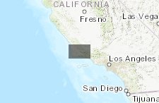
- This map shows land cover classifications, carbon stocks, and nitrous oxide emissions for Santa Barbara County in 2016. This map includes five data layers prepared by the Bren Carbon Counters; more details about each layer can be found by clicking on each dataset below.
- Location
- Credits
- Data layers prepared by Bren Carbon Counters (Alicia Fennell, Gavriella Keyles, Madeline Oliver, Minerva Ringland, and Michael Wells)
- Use Constraints
 This work is licensed under a Creative Commons Attribution 3.0 License.
This map is visible to everyone
Bookmarked by
1 Group
About the Map Author
Carbon Counters
Student with Bren School of Environmental Science & Management
We are a group of five master's graduates at the Bren School at UC Santa Barbara. Our master's group project was evaluating the climate mitigation potential of natural & working lands in Santa Barbara County, conducted in partnership with the County's Sustainability Division.