- Data Basin |
- Maps |
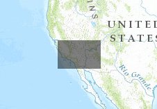
- DRECP aggregated vegetation cover 2050 - MC2 simulation results RCP 8.5
DRECP aggregated vegetation cover 2050 - MC2 simulation results RCP 8.5
Oct 10, 2013
(Last modified Jun 29, 2015)
Created by
Dominique Bachelet

- Description
- we used CMIP5 downscaled climate futures to run the MC2 dynamic global vegetation model and simulate vegetation cover from 1895 to 2100. We aggregated vegetation types to facilitiate visualization.
- Location
- Credits
- climate: CMIP5 and J. Abatzoglou; T. Sheehan fr MC2 runs; R. Nemani for NEX access
- Use Constraints
 This work is licensed under a Creative Commons Attribution 3.0 License.
This map is visible to everyone
Included in
1 Public Gallery
About the Map Author
Dominique Bachelet
climate change scientist with Oregon State University
Dominique received her Master’s degree in 1978 in Lille (France) and her Ph.D. in 1983 from Colorado State University with a thesis focused on biogeochemical cycles in the shortgrass prairie. In 1984 she went to U.C. Riverside as a postdoc simulating nitrogen fixing shrubs in the Sonoran desert then...