- Data Basin |
- Maps |
- Pre-Contact Tribal Territories
Pre-Contact Tribal Territories
Dec 28, 2015
(Last modified Feb 2, 2016)
Created by
Inyo County Planning Department

- Description
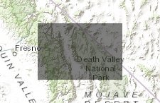
- Ethnographic data depict the traditional lands of Native American groups in the OVSES and adjacent parts of Inyo County. These data are based on maps derived from the Californian Indian Library Collection and have been digitized by HELIX for the purpose of this study. These data are for informational purposes only and may not be spatially accurate.
- Location
- Credits
- Californian Indian Library Collections (digitized by HELIX Environmental Planning)
- Use Constraints
 This work is licensed under a Creative Commons Attribution 3.0 License.
This map is visible to everyone
Included in
2 Public Galleries
About the Map Author
Inyo County Planning Department
with County of Inyo
The Planning Department is charged with the orderly growth and development of the County while maintaining its quality of life and natural environment. We serve as staff to the Inyo County Planning Commission; administer the County's Zoning, Subdivision, Environmental Review, and Surface Mining...