- Data Basin |
- Maps |
- FEMA Flood Zones & Sensitive Populations - Climate Impacts
FEMA Flood Zones & Sensitive Populations - Climate Impacts
Mar 24, 2018
Created by
Cam Gray

- Description
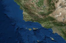
- A map showing FEMA Flood zones with overlays for populations that are more likely to be sensitive and exposed to flooding impacts.
- Location
- Credits
- Dustin Pearce, Cameron Gray
- Use Constraints
 This work is licensed under a Creative Commons Attribution 3.0 License.
This map is visible to everyone
About the Map Author
Cam Gray
Transportation & Climate Specialist with Community Environmental Council
The Community Environmental Council (CEC) creates regional climate change solutions. Our team is committed to enhancing local access to clean energy and sustainable transportation options, with an emphasis on the pathways will help us build more resilient, equitable, and just communities.