- Data Basin |
- Maps |
- Portland Metro Region Natural Resources
Portland Metro Region Natural Resources
Dec 19, 2013
Created by
Katie O'Connor

- Description
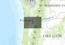
- This map depicts the landcover from the Intertwine RCS, along with trails, natural areas, and historic flooding in the Portland Metro area.
- Location
- Credits
- Katie O'Connor
- Use Constraints
 This work is licensed under a Creative Commons Attribution 3.0 License.
This map is visible to everyone
About the Map Author
Katie O'Connor
Freshwater Specialist/GIS Technician with Conservation Biology Institute
I have a background in watershed science, collaboration, data collection, and geospatial data management. I currently work for Conservation Biology Institute as the Freshwater Specialist/GIS Technician.