- Data Basin |
- Maps |
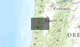
- Pacific Northwest NLCD 2006 All Forest Cover (5km context)
Pacific Northwest NLCD 2006 All Forest Cover (5km context)
Jan 16, 2013
(Last modified Jan 17, 2013)

- Description
- Each 1km cell shows forest cover percent within 5km radius.
- Location
- Credits
- Phil Nott, The Institute for Bird Populations
- Use Constraints
 This work is licensed under a Creative Commons Attribution 3.0 License.
This map is visible to everyone
- This map was used to create these maps
-
About the Map Author
Phil Nott, The Institute for Bird Populations
Research Ecologist with The Institute for Bird Populations
I'm a research ecologist and program director at the Institute for Bird Populations. My major role is researching the Monitoring Avian Productivity and Survivorship (MAPS) landbird monitoring database towards providing management models to land stewards. I have conducted three regional analyses of...