- Data Basin |
- Maps |
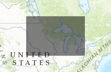
- MN Prairie Plan
MN Prairie Plan
Feb 5, 2017
Created by
Nadejda Mirochnitchenko

- Description
- This map highlights the areas with low CRP enrollment so that more land acquisition efforts can expand conservation related lands to the areas that do not have a lot of protected areas.We wanted to include other information such as areas with many grassland birds, and impaired areas (so that we can reduce the amount of impaired areas in the state), but we ran out of time and did not have all of the spatial analyst tools in Data Basin.
- Location
- Credits
- Introduction to Data Basin land the Midwest Grassland Conservation Area Workshop
- Use Constraints
 This work is licensed under a Creative Commons Attribution 3.0 License.
This map is visible to everyone
Included in
1 Public Gallery
About the Map Author
Nadejda Mirochnitchenko
Graduate Student with Nebraska Cooperative Fish and Wildlife Research Unit
Currently, I am a graduate student with the Nebraska Cooperative Fish and Wildlife Research Unit where I am studying the biodiversity of birds within Nebraska and how biodiversity metrics can impact conservation and management planning. I am broadly interested in ecological interactions and the...