- Data Basin |
- Maps |
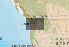
- >70% change of range expansion or contraction for Grand fir 2000-2009
>70% change of range expansion or contraction for Grand fir 2000-2009
Aug 5, 2014
Created by
Richard Waring

- Description
- Grand fir (Abies grandis) Little's range map; decision tree model predictions; USFS FIA survey plot locations where species was recorded as present
- Location
- Credits
- Coops, Mathys, Waring
- Use Constraints
 This work is licensed under a Creative Commons Attribution 3.0 License.
This map is visible to everyone
About the Map Author
Richard Waring
Professor emeritus with Oregon State University
My early work dealt with describing the distribution and growth of forest vegetation in relation to measured environmental gradients. In the 1980s, my interest turned toward ecosystems. More recently, my research has focused on modeling forest growth and biodiversity under changing climates, along...