- Data Basin |
- Maps |
- Southwestern US Ecoregions - Overlap Method
Southwestern US Ecoregions - Overlap Method
Feb 24, 2017
(Last modified Jun 13, 2021)
Created by
David Cristiani

- Description
- Dryland and adjacent ecoregions in the southwestern US, and the approximate extents of their major attributes of climate, flora, and fauna.An ongoing map.
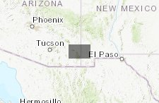
- Location
- Credits
- David Cristiani
- Use Constraints
 This work is licensed under a Creative Commons Attribution 3.0 License.
This map is visible to everyone
About the Map Author
David Cristiani
Environmental Designer with QUERCUS
I'm continuing my study, research, and observation of ecoregions. That work applies to more informed land management practices and to create a more accurate system of climate zones for horticulture. . I've been a landscape architecture and design practitioner for 31 years, owning my design practice...