- Data Basin |
- Maps |
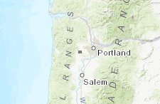
- OakQuest 2018 with Historic Vegetation
OakQuest 2018 with Historic Vegetation
Sep 4, 2018
Created by
Tommy Albo

- Description
- Combining the OakQuest 2018 data with pre-settlement vegetation circa 1850's.Please be sure to turn on and off layers in the layer tab to help with performance.
- Location
- Credits
- metro
- Use Constraints
 This work is licensed under a Creative Commons Attribution 3.0 License.
This map is visible to everyone
Bookmarked by
3 Members
About the Map Author
Tommy Albo
GIS Coordinator with OregonMetro
Metro, and the region's voters have successfully passed two bond measures these past 15 years, to conserve over 300 acquisitions totally more than 12,000 acres. I am fortunate to assist and coordinate the negotiators, the legal team and the scientist with their GIS needs. Helping prioritize and keep...