- Data Basin |
- Maps |
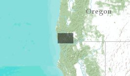
- OHV Planning Map for Illinois Valley Landscape Assessment
OHV Planning Map for Illinois Valley Landscape Assessment
Jul 10, 2012
(Last modified Jul 11, 2012)
Created by
Jim Wolf

- Description
- OHV Planning Map for Illinois Valley Landscape Assessment showing motored use designations and/or road status.
- Location
- Credits
- USFS, OR/WA BLM, Jim Wolf
- Use Constraints
 This work is licensed under a Creative Commons Attribution 3.0 License.
This map is visible to everyone
About the Map Author
Jim Wolf
Plan Coordindator with Josephine and Jackson County CWPPs
Currently serving in several capacities: The agency project manager for the west wide wildfire risk assessment, a project sponsored by the Western Forestry Leadership Coalition and Council of Western State Foresters. Serving on the operations group of the Illinois Valley Landscape Assessment as a...