- Data Basin |
- Maps |
- National Wilderness Preservation System Map
National Wilderness Preservation System Map
Jan 3, 2012
(Last modified Oct 3, 2019)
Created by
Lisa Ronald
- Description
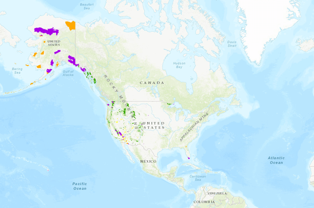
- This map shows official federal agency boundaries for all wilderness areas managed by the Bureau of Land Management, Fish and Wildlife Service, Forest Service and National Park Service. Collectively, these areas comprise the National Wilderness Preservation System. Boundaries are displayed through an ArcGIS Online-hosted tile service and feature service maintained by the University of Montana's Wilderness Institute. Additional download formats and information are available online.
- Location
- Credits
- Lisa Ronald, Wilderness Institute, University of Montana
- Use Constraints
- This data is available for public use of any kind. Crediting Wilderness Connect is requested. Wilderness Connect maintains and updates wilderness boundary data annually using official national agency wilderness GIS sources and acreage data from agency Realty Offices.
This map is visible to everyone
Bookmarked by
2 Members
About the Map Author
Lisa Ronald
Wildlands Communications Director with Wilderness Institute
For more than 15 years, I have been a motivated environmental communications linchpin with experience developing national media strategies and forging diverse partnerships that create long-lasting place-based connections and ultimately protect wild places. My work includes creating and overseeing...