- Data Basin |
- Maps |
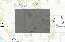
- Utah Forest Network
Utah Forest Network
Jun 21, 2016
Created by
Wild Utah Project

- Description
- Utah Forest Network's Citizens' Wilderness Proposal for National Forest lands in Utah, and some abutting units on BLM lands in Utah. All proposed lands and human impacts were visited by staff and volunteers and documented on 1:24,000 USGS quadrangles through field checking of each area by land or by aerial photo. Field checking involved visits to every potentially significant human impact in surveyed roadless areas. These were photographed and made part of a continuing paper data file.
- Location
- Credits
- Wild Utah Project
- Use Constraints
 This work is licensed under a Creative Commons Attribution 3.0 License.
This map is visible to everyone
About the Map Author
Wild Utah Project
Wild Utah Project is a 501(c)(3) non-profit organizations that provides scientific research, technical support including the development of ecological assessment methods and conservation tools, and computer mapping analyses using Geographic Information Systems (GIS) to land managers, citizen...