- Data Basin |
- Maps |
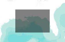
- Deepwater Horizon Gulf of Mexico oil spill, projected for 7/25/2010
Deepwater Horizon Gulf of Mexico oil spill, projected for 7/25/2010

- Description
- Projected spill trajectory and protected area overlap for 07/25/2010 oil spill projections, created on 07/22/2010.
For more information, please see dataset metadata, or Deepwater Horizon Gulf of Mexico oil spill gallery.This map contains datasets related to the Deepwater Horizon Gulf of Mexico oil spill, and the protected areas it may affect.
The Conservation Biology Institute has created data to describe the Deepwater Horizon oil spill and to begin to discern the possible damage it could cause to terrestrial, estuarine, and freshwater ecosystems should it make landfall. Using oil spill trajectories produced by the Ocean Circulation Group and the Optical Oceanography Laboratory at the College of Marine Science, University of South Florida, and protected areas data catalogued in PAD-US (CBI Edition) , we provide a preliminary attempt to identify ecological resources that may be affected by the spill.By overlaying these projected trajectories on a standardized grid, we can select areas that may contain oil from the spill, or are likely to contain oil in the future. We then identify protected areas that are likely to be most directly affected by the spill immediately, and in the near future. We list these areas in a Google spreadsheet.
CBI will continue to update these datasets with future spill trajectory projections. Each update will include geospatial data on the spill trajectory, areas of possible landfall, and the affected protected areas. We want these freely available data will be useful to anyone interested in learning more about the oil spill and its ecological effects.
More information is available at the Data Basin Oil Spill in the Gulf of Mexico page.
- Location
- Credits
- Conservation Biology Institute
- Use Constraints
 This work is licensed under a Creative Commons Attribution 3.0 License.
- This map is based on
-
About the Map Author
We provide advanced conservation science, technology, and planning to empower our partners in solving the world’s critical ecological challenges