- Data Basin |
- Maps |
- Ivory Coast Watersheds
Ivory Coast Watersheds
Mar 27, 2018
Created by
Michael Flaxman

- Description
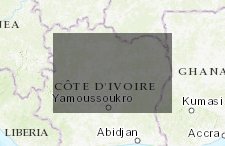
- Just a zoom on HYDROSHEDS (BAS) - AFRICA DRAINAGE BASINS (WATERSHED BOUNDARIES) AT 30S
- Location
- Credits
- Data Basin data
- Use Constraints
 This work is licensed under a Creative Commons Attribution 3.0 License.
This map is visible to everyone
About the Map Author
Michael Flaxman
Founder with Geodesign Technologies Inc
I am a conservation-oriented landscape planner, focusing on geodesign and large scale urban growth simulation. I have served as faculty at MIT, taught geographic information systems at all levels, and worked as an Industry Manager for AEC at ESRI. I am in the process of launching a startup focusing...