- Data Basin |
- Maps |
- Crocodylus intermedius
Crocodylus intermedius
Feb 5, 2016
Created by
Sergio A. Balaguera-Reina

- Description
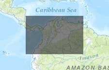
- This database reflects Crocodylus intermedius geolocations collected under the umbrella of the Crocs Geo-Visor Initiative. Data were collected directly from literature and field by authors or researchers whom kindly share their information with this initiative. A list of authors who supported this initiative can be found in the main page Crocs Geo-Visor Initiative. For more information please contact sergio.balaguera-reina@ttu.edu
- Location
- Credits
- Sergio A. Balaguera-Reina
- Use Constraints
 This work is licensed under a Creative Commons Attribution 3.0 License.
This map is visible to everyone
About the Map Author
Sergio A. Balaguera-Reina
Graduate student with Texas Tech University
Marine biologist, PHD student at Texas Tech University and IUCN/SSC/Crocodile Specialist Group member. My current work is about ecology and conservation of Crocodiles in Colombia and Panama.