- Data Basin |
- Maps |
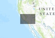
- Change in the extent of barren land in DRECP area (PCM)
Change in the extent of barren land in DRECP area (PCM)
Jun 21, 2013
(Last modified Jun 25, 2013)
Created by
Dominique Bachelet

- Description
- John Kim ran the MC1 model, calibrated for the state of California, and simulated vegetation shifts under a suite of future climate scenarios. The extent of barren land increases as temperatures rise and water availability decreases.
- Location
- Credits
- John Kim et al.
- Use Constraints
 This work is licensed under a Creative Commons Attribution 3.0 License.
This map is visible to everyone
Bookmarked by
2 Groups
Included in
1 Public Gallery
- This map was used to create these maps
-
About the Map Author
Dominique Bachelet
climate change scientist with Oregon State University
Dominique received her Master’s degree in 1978 in Lille (France) and her Ph.D. in 1983 from Colorado State University with a thesis focused on biogeochemical cycles in the shortgrass prairie. In 1984 she went to U.C. Riverside as a postdoc simulating nitrogen fixing shrubs in the Sonoran desert then...