- Data Basin |
- Maps |
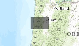
- Pacific Northwest Topography (derived from USGS TOPO30)
Pacific Northwest Topography (derived from USGS TOPO30)
Jan 17, 2013

- Description
- Topographical layers for Pacific Northwest
- Location
- Credits
- USGS TOPO30, Phil Nott, The Institute for Bird Populations
- Use Constraints
 This work is licensed under a Creative Commons Attribution 3.0 License.
This map is visible to everyone
About the Map Author
Phil Nott, The Institute for Bird Populations
Research Ecologist with The Institute for Bird Populations
I'm a research ecologist and program director at the Institute for Bird Populations. My major role is researching the Monitoring Avian Productivity and Survivorship (MAPS) landbird monitoring database towards providing management models to land stewards. I have conducted three regional analyses of...