- Data Basin |
- Maps |
- Threats To Wildlife Habitat In Florida
Threats To Wildlife Habitat In Florida
Dec 9, 2015
(Last modified Feb 16, 2019)

- Description
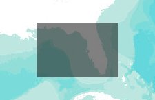
- This map overlays sea level rise and development projections on the Florida Fish and Wildlife Commission's species potential habitat models. This map also includes FNAI's managed lands dataset to assist with location identification.
- Location
- Credits
- PFLCC Staff
- Use Constraints
 This work is licensed under a Creative Commons Attribution 3.0 License.
This map is visible to everyone
Bookmarked by
1 Group
Included in
1 Public Gallery
About the Map Author
Peninsular Florida Landscape Conservation Cooperative
GIS Staff with PFLCC
The Peninsular Florida Landscape Conservation Cooperative (PFLCC) is part of a national network of Landscape Conservation Cooperatives(LCCs). LCCs are applied conservation science partnerships among federal agencies, regional organizations, states, tribes, NGOs, private stakeholders, universities...