- Data Basin |
- Maps |
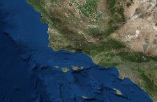
- South Coast - Lidar Map
South Coast - Lidar Map
May 24, 2018
(Last modified Jul 31, 2018)
Created by
SB Atlas Admin

- Description
- This maps shows Lidar datasets generated across the South County of Santa Barbara County after the debris flows that occurred in 2018. To turn on or off layers please use layers tab on the left side of the screen.To learn more about using the Atlas please visit our tutorial here: SB Atlas Tutorial .Please contact Dustin Pearce (dustin.pearce@consbio.org) if you have any questions on this map.
- Location
- Credits
- Dustin Pearce
- Use Constraints
 This work is licensed under a Creative Commons Attribution 3.0 License.
This map is visible to everyone
Bookmarked by
2 Members
,
2 Groups
Included in
1 Public Gallery
About the Map Author
SB Atlas Admin
Admin Account with Santa Barbara County Conservation Blueprint
The purpose of the Blueprint is to provide a public data platform and common language to support in depth conversations and decisions about our shared aspirations. This collaborative project aims to describe the current landscape, natural resources, and community values about land in Santa Barbara...