- Data Basin |
- Maps |
- HUC 8 Watershed Boundary Dataset USA
HUC 8 Watershed Boundary Dataset USA
Jul 1, 2016
Created by
Tosha Comendant
- Description
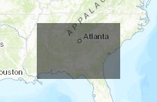
- HUC 8 watersheds in Georgia and surrounding region
- Location

- Credits
- Tosha Comendant
- Use Constraints
 This work is licensed under a Creative Commons Attribution 3.0 License.
This map is visible to everyone
About the Map Author
Tosha Comendant
Senior Conservation Scientist with Conservation Biology Institute
Senior Scientist at Conservation Biology Institute working on the conversion of scientific knowledge into conservation practice. Team lead for Conservation Planning and Management.I am one of the creators of Data Basin, a science-based mapping and analysis platform that supports education, research,...


