- Data Basin |
- Maps |
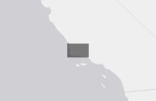
- Private Forest Land - Santa Barbara County
Private Forest Land - Santa Barbara County
Apr 19, 2019
Created by
SB Atlas Admin

- Description
- This map shows private forest land in Santa Barbara County. Conservation easements are not included in this map but may be turned on in the layers tab on the left (click on CCED Update 2018).
Please contact Dustin Pearce (dustin.pearce@consbio.org) if you have any questions on this map.
- Location
- Credits
- Dustin Pearce
- Use Constraints
 This work is licensed under a Creative Commons Attribution 3.0 License.
This map is visible to everyone
About the Map Author
SB Atlas Admin
Admin Account with Santa Barbara County Conservation Blueprint
The purpose of the Blueprint is to provide a public data platform and common language to support in depth conversations and decisions about our shared aspirations. This collaborative project aims to describe the current landscape, natural resources, and community values about land in Santa Barbara...