- Data Basin |
- Maps |
- Flora and Fauna - Connected Lands Inset Map
Flora and Fauna - Connected Lands Inset Map
Dec 20, 2017
Created by
SB Atlas Admin

- Description
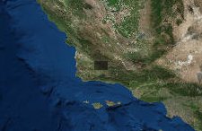
- This map shows the Midland School Conservation Easement and the Sedgwick Reserve Conservation Easement in relation to the large protected lands of Los Padres National Forest.To learn more about using the Atlas please visit our tutorial here: SB Atlas Tutorial.
Please contact Dustin Pearce (dustin.pearce@consbio.org) if you have any questions on this map.
- Location
- Credits
- SB Atlas Admin
- Use Constraints
 This work is licensed under a Creative Commons Attribution 3.0 License.
This map is visible to everyone
About the Map Author
SB Atlas Admin
Admin Account with Santa Barbara County Conservation Blueprint
The purpose of the Blueprint is to provide a public data platform and common language to support in depth conversations and decisions about our shared aspirations. This collaborative project aims to describe the current landscape, natural resources, and community values about land in Santa Barbara...