- Data Basin |
- Maps |
- Parks and Park Needs in Santa Barbara County (2019 Draft)
Parks and Park Needs in Santa Barbara County (2019 Draft)
Dec 3, 2018
(Last modified Nov 17, 2021)
Created by
SB Atlas Admin

- Description
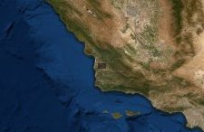
- Map showing parks, park service areas within a 10 minute walk, population metrics, and existing schools.
Note: Several of the layers are unchecked by default. Use the layers tab to turn them on.
To learn more about using the Atlas please visit our tutorial here: SB Atlas Tutorial, or watching a guided video here: SB Atlas Tutorial Video.This is the draft map in 2019, an updated product is coming soon.
- Location
- Credits
- Dustin Pearce
- Use Constraints
 This work is licensed under a Creative Commons Attribution 3.0 License.
This map is visible to everyone
Bookmarked by
2 Members
,
1 Group
About the Map Author
SB Atlas Admin
Admin Account with Santa Barbara County Conservation Blueprint
The purpose of the Blueprint is to provide a public data platform and common language to support in depth conversations and decisions about our shared aspirations. This collaborative project aims to describe the current landscape, natural resources, and community values about land in Santa Barbara...