- Data Basin |
- Maps |
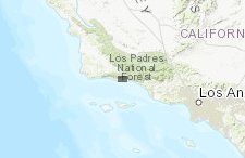
- Projected Sea Level Rise - Santa Barbara County
Projected Sea Level Rise - Santa Barbara County
Mar 30, 2017
(Last modified Feb 12, 2020)
Created by
SB Atlas Admin

- Description
- Areas of projected sea level rise, erosion hazard, and flood risk for Santa Barbara County.
- Location
- Credits
- SB Atlas Admin
- Use Constraints
 This work is licensed under a Creative Commons Attribution 3.0 License.
This map is visible to everyone
Bookmarked by
1 Group
About the Map Author
SB Atlas Admin
Admin Account with Santa Barbara County Conservation Blueprint
The purpose of the Blueprint is to provide a public data platform and common language to support in depth conversations and decisions about our shared aspirations. This collaborative project aims to describe the current landscape, natural resources, and community values about land in Santa Barbara...