- Data Basin |
- Maps |
- Santa Barbara County Coastal Resiliency Hazards
Santa Barbara County Coastal Resiliency Hazards
Sep 15, 2017
(Last modified Oct 2, 2017)
Created by
SB Atlas Admin

- Description
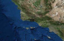
- Map showing where coastal hazards were identified by the COUNTY OF SANTA BARBARA Coastal Resiliency Project - Sea Level Rise & Coastal Hazards Vulnerability Assessment. Additional data on sea level rise available as well.To learn more about using the Atlas please visit our tutorial here: SB Atlas Tutorial.
Please contact Dustin Pearce (dustin.pearce@consbio.org) if you have any questions on this map.
- Location
- Credits
- Santa Barbara Atlas
- Use Constraints
 This work is licensed under a Creative Commons Attribution 3.0 License.
This map is visible to everyone
Included in
1 Public Gallery
About the Map Author
SB Atlas Admin
Admin Account with Santa Barbara County Conservation Blueprint
The purpose of the Blueprint is to provide a public data platform and common language to support in depth conversations and decisions about our shared aspirations. This collaborative project aims to describe the current landscape, natural resources, and community values about land in Santa Barbara...