- Data Basin |
- Maps |
- Land Use Change Over Time - Santa Barbara County
Land Use Change Over Time - Santa Barbara County
Apr 18, 2017
(Last modified Aug 23, 2021)
Created by
SB Atlas Admin

- Description
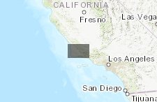
- Map showing land use change over time. Click on the play button in the in the bottom left hand corner to start the animation.Note: Several of the layers are unchecked by default. Use the layers tab to turn them on. Some data sources have changed over the years in the animation, so there are some slight discrepancies in the FMMP data.To learn more about using the Atlas please visit our tutorial here: SB Atlas Tutorial, or watching a guided video here: SB Atlas Tutorial Video.Please contact info@sbcblueprint.net if you have any questions on this map or the Atlas.
- Location
- Credits
- Santa Barbara Blueprint
- Use Constraints
 This work is licensed under a Creative Commons Attribution 3.0 License.
This map is visible to everyone
Bookmarked by
2 Members
,
1 Group
Included in
1 Public Gallery
About the Map Author
SB Atlas Admin
Admin Account with Santa Barbara County Conservation Blueprint
The purpose of the Blueprint is to provide a public data platform and common language to support in depth conversations and decisions about our shared aspirations. This collaborative project aims to describe the current landscape, natural resources, and community values about land in Santa Barbara...