- Data Basin |
- Maps |
- Fires - Santa Barbara County
Fires - Santa Barbara County
Jul 22, 2017
(Last modified Aug 3, 2017)
Created by
SB Atlas Admin

- Description
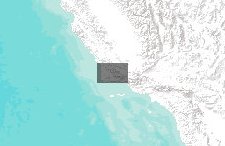
- Map of current fires in Santa Barbara County and historical fires (filtered to only show fires since 2000).Note: Several of the layers are unchecked by default. Use the layers tab to turn them on.
- Location
- Credits
- Santa Barbara Blueprint
- Use Constraints
 This work is licensed under a Creative Commons Attribution 3.0 License.
This map is visible to everyone
About the Map Author
SB Atlas Admin
Admin Account with Santa Barbara County Conservation Blueprint
The purpose of the Blueprint is to provide a public data platform and common language to support in depth conversations and decisions about our shared aspirations. This collaborative project aims to describe the current landscape, natural resources, and community values about land in Santa Barbara...